1818 and 1870 Surveys and 1939 Aerial photos pin-point Granby
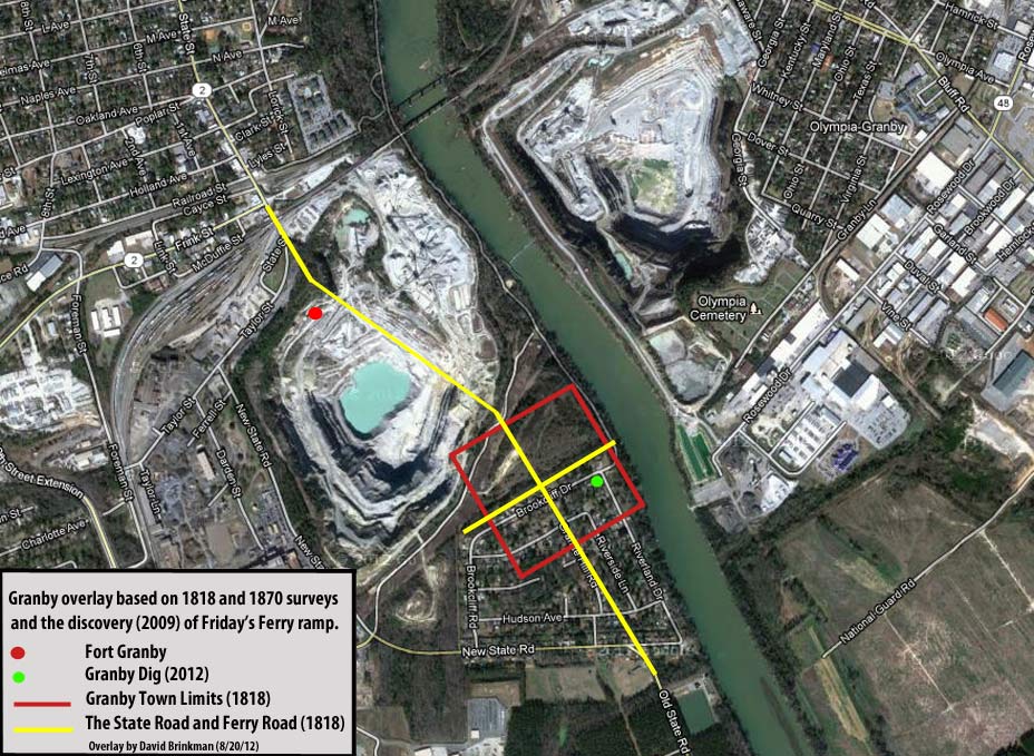
To locate Granby, we use two proven surveys from 1818 and 1870. The 1870 Columbia Canal survey was commissioned by one of the world's richest men (who was also a US Senator) and completed by the State Surveyor of Rhode Island. It was donated to the South Carolina Archives in 2008 after being lost for decades. This survey was used to locate the old site of the Confederate Broad River Bridge and Sherman's pontoon crossing. This case was featured on the 2009 PBS show History Detectives. The 1870 survey covered over 5 miles of the Columbia canal. There is no noticeable error in the survey overlay from the head of the Columbia canal to the 1870 railroad trestle (replaced by the 1900 bridge that stands today) over the Congaree River in Cayce. The survey also showed a creek that is located on the East side of the Congaree River, opposite from the northern boundary of the town of Granby as shown in the 1818 surveys of South Carolina. The 1818 survey also showed the dimensions of Granby and the relative positions of the old State Road and the road to Friday's Ferry. The 1818 survey shows the grid of Columbia and because the city blocks exactly match the dimensions of today's blocks and exactly agrees with the outlines of North Main Street, Broad River Road, and Bush River Road, we can assume that the 1818 dimensions of Granby are also accurate. Using this Northern boundary and the dimensions, the outline of Granby was placed on today's map (see below). In the overlay, the road to the Granby Ferry matches exactly with the recently found ferry ramp which Historians believe was Friday's Ferry. A line connecting today's old State Road (at points North and South of the Cayce Quarry), cuts a line exactly through the center of this 1818 Granby grid just where the 1818 survey showed it. This shows that the Granby drawing of the early 1900's (in the Cayce Museum) is not accurate because it connects Granby with the Northern edge of Saxe Gotha and shows Fort Congaree II in the middle of Granby. Granby did not extend this far South. This also explains why recent Archaeology work (by Natalie Adams Pope) done on a river lot in the center of today's Riverland Park neighborhood was void of artifacts. This property was South of the town boundaries as pin-pointed by this most recent overlay. The 1818 survey shows a high concentration of buildings along the old State Road through Granby. This area would be an excellent target for future digs. Unfortunately, a big part of Granby is in the Cayce Quarry property and buried under a slag pile.
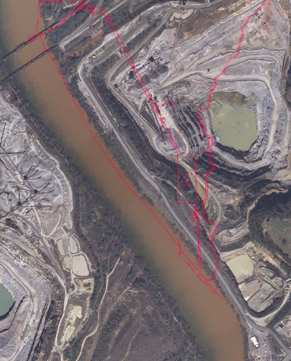
Below are several images of the 1870 survey with overlays on the Cayce portion of the survey.
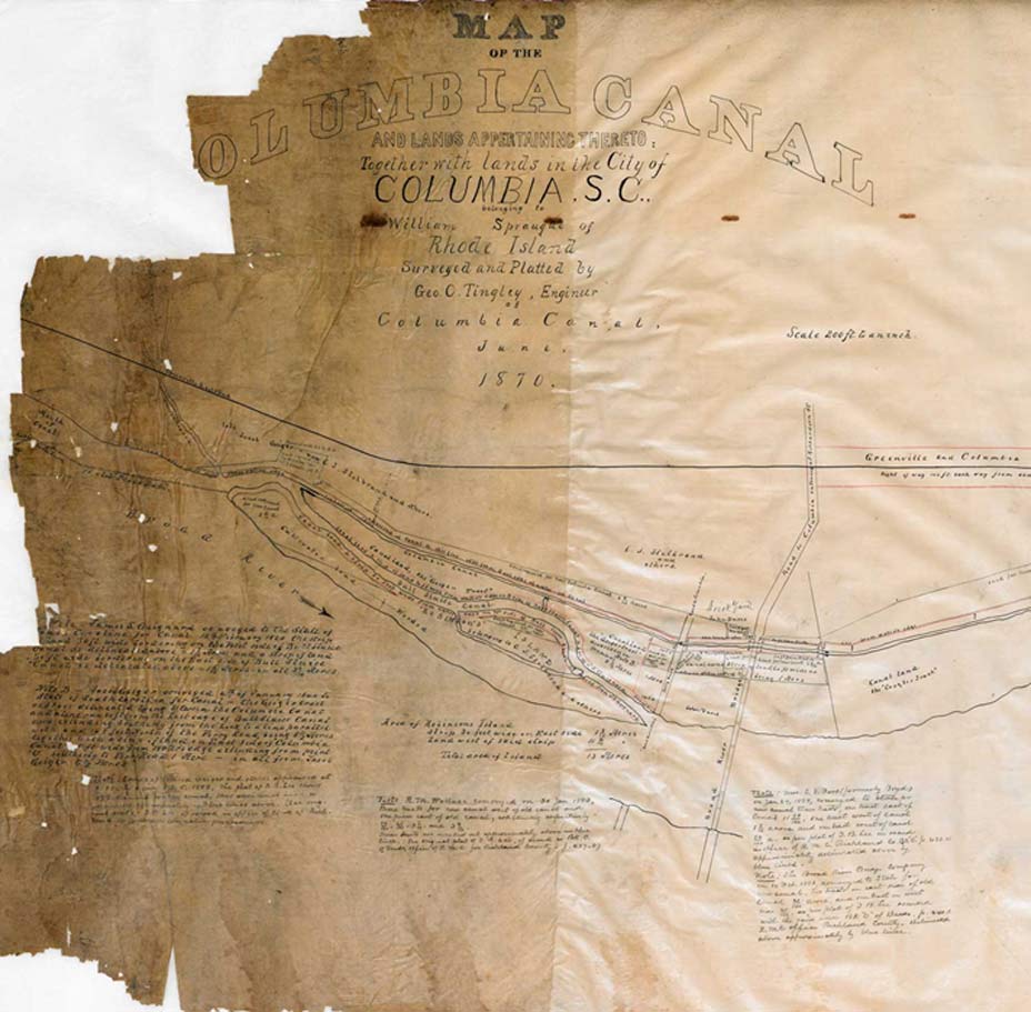
Notice, below, that the 1870 creek enters the East side of the Congaree river in line (perpendicular with the river)
with the Northern boundary of the Olympia Cemetery. This reference point will be used to align the Granby grid on the West side of the River.
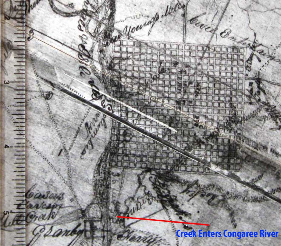
Below is the 1818 survey showing the Columbia grid and the Granby grid with our reference point (creek) just East of the Northern boundary of Granby.
And.. all the data (1818, 1870, and today).. This is Granby...
Granby Town Blocks
The following image was built from several pieces of historical information as well as building location data built from artifact recovery in the Granby dig. A proposed addition to Granby in 1786 showed the new lots to be 100 feet by 200 feet. There were 8 lots per block. This 1786 map did not show the divided lots in Old Granby but the block size matched the blocks in the proposed addition. In 1791, advertisements appeared in a Charleston newspaper for lots in Old Granby just 100 yards from the ferry landing. These lots were noted as being in the business section of Granby and they were also 100 feet by 200 feet. When applying this information on top of today's map, the Old State road lines up exactly with where the Old State Road continues below the Riverland Park neighborhood. It also lines up with a visible old road bed going into the Quarry property off Brookcliff Road (near Granite Hill Road). Property on the west side of the Old State Road probably had larger lots and some newspaper advertisements confirm that some lots were larger than 100 feet by 200 feet. The 1800 Census listed 28 households. The following town size would have supported this along with additional business buildings and larger lots.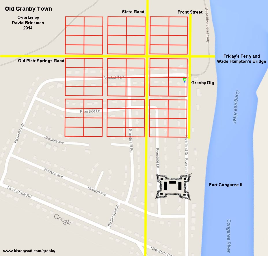
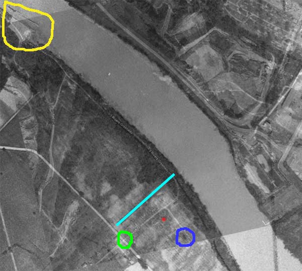
1939 Aerial photo overlay
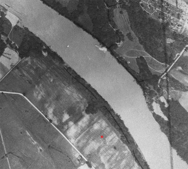
The following overlay and animation overlay show a 1939 aerial photo overlay onto a 2012 aerial photo. The first static image shows areas to look at in the animation. The 1939 and 2012 images were aligned using the outline of the Congaree River and the Granby Locks (circled in yellow). The red dot is our Granby dig location. The light blue line shows what we believe is the surviving trace of the old road going to Friday's Ferry. The green circle is the intersection of today's Brookcliff Street with the old State Road. This would have been the area of the old Granby Courthouse, Jail, and Lodging buildings. Another area that would be good to look at in the future is circled in dark blue. Archaeologists like to investigate dark areas like this as they can indicate past human habitation.