1818 Lexington/Richland Surveys by Blackburn/Coate
The following overlays were done in 2009 before there was any thought about Finding Granby. The 1818 surveys were used to build the 1825 Mills Atlas. The surveys are amazingly accurate as can be seen with a simple overlay on today's map. George Blackburn was a mathematician and Astronomer and he used extensive Astronomical observations/measurements on his surveys. He is credited with completing the first Longitude mapping of South Carolina.
Below is the 1818 Blackburn/Coate from SCDAH
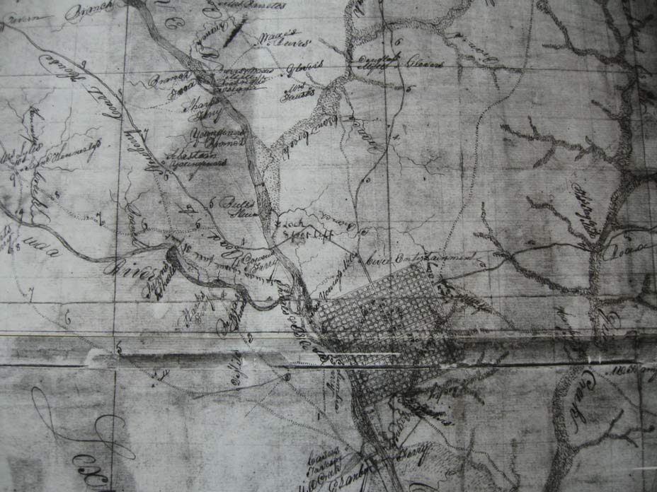
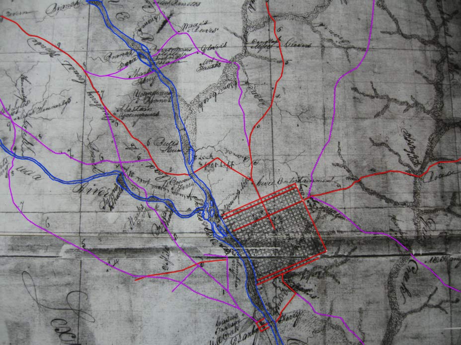
In step 2 of the overlay process, the main features are traced so they will be more visible in the overlay.
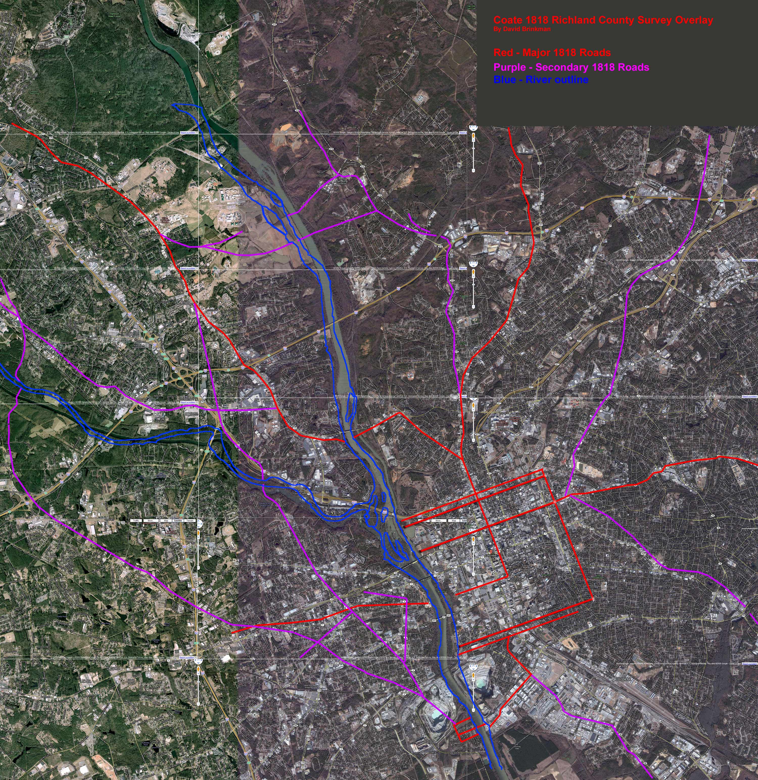
Below, the trace layer is placed on today's map and rotated and scaled to match the scale of today's map. The main alignment was based on the roads of North Main, River Drive, and Broad River Road. There is almost no error between the 1818 survey and today's map on these roads. As you move South, there appears to be a slight skew given that we now know the location of Friday's Ferry in Granby. Never-the-less, the 1818 surveys were exceptional for their time. You can click on the following map to get a full sized image where you can read the street names (you may need to click a second time to zoom into this larger image).