Fort Congaree II - 20th Century Evidence
Fort Congaree II Location
The old State Road runs vertically through the center of the following 1939 aerial image.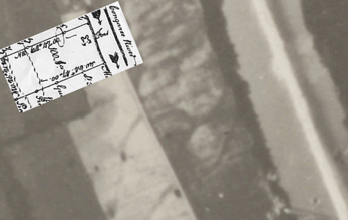
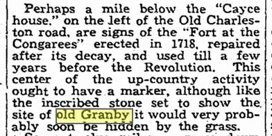
The Red line in this animation shows an outline of a shape that matches the shape and orientation of the fort as shown in a 1750 plat of the land. This matches the location determined by the Granby Dig team based on a mid-1700's survey but it shows the fort is larger than expected. More like 400' X 400' feet which is double the size of Fort Moore which preceded it (near Augusta). It could be that this dark spot was formed by the enclosure of the fort by its moat so the fort could have been half this size. The area of this outline would have gone from the river all the way to almost where the old state road ran. The remnants of two roads can be seen coming in from the southwest and circling this spot. The 1939 background aerial photo shows the Congaree to be shallow at this expected location of the fort. Documents state that the fort was built at the site of an old Indian trail which would have required a ford in the river. It was documented in 1935 that there were signs of the fort at this location just to the left side (traveling south) of the old State Road. The image in the upper left corner is the 1750 plat showing the fort. The blue rectangle is an area that the Granby team surveyed early in 2013 (with permission from the land owner). Below is the 1935 article by Historian Dr. Edwin Green in The State. Keep in mind that Fort Congaree 1 had not been found in 1935 and Dr. Green gets the date confused with the first fort. Fort Congaree 2 was made in 1748 and is exactly 1 mile below where the old Cayce house stood. Fort Congaree 1 (found in the 1970's) is 3 miles south of the old Cayce house. Dr. Green's 1 mile distance and the proximity to the old State Road leave little doubt that he was observing the remnants of Fort Congaree 2. |
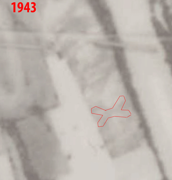
Below is a similar animation but using a 1943 aerial photo and the area now covers what would become the entire Riverland Park neighborhood in 1960. The fort outline is still there although it has faded from 4 years of plowing. There is no sign of the roads that came into and around the fort in the 1939 aerial. Notice the corner of Riverland Drive and Brookcliff Drive. That dark spot is where we are finding the high concentration of artifacts in the Granby dig. |
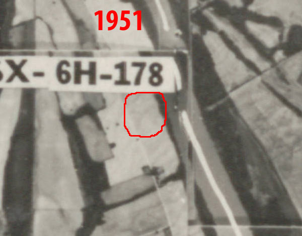
Below is an aerial from 8 years later (1951). More plowing has faded the outline a little bit more.
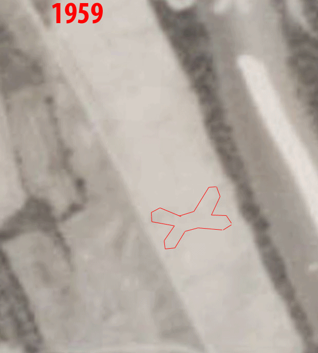
Below is a similar animation but over the 1959 aerial. Another 16 years of plowing has almost erased the fort outline but there is still a little left. In another year, the Riverland Park neighborhood will be built on top of the old fort and it will be forgotten until now. |