Our Granby Homestead
Our Granby Homestead

Applying a Gaussian blur filter to our artifact statistics maps shows
us how the distribution of pottery artifacts and architecture artifacts
(and features) seem to show a distinctive living area in the house and
a food storage area. The storage area may have been a separate building
or it may have been another building attached to the main house.
Property descriptions of Granby show that most properties had multiple
buildings (the main house, a store house, a smoke house, a stable, a
kitchen, and (of course), a privy.
Below
are the blurred statistic maps and how these give us this theory. The
color red is a high number of artifacts, orange is medium high, yellow
is medium, and grey is low.

Above: The stoneware (used for storing food) is clearly more present in the South. Kitchen pottery is also strong there as well as moving North into the mid section of the hot zone. It makes sense that a Kitchen would be adjacent to the food storage area. Note: The other strong area of stoneware on the North-end was made up of older stoneware pieces that may pre-date Granby and could possibly be from the original owner of the land (Thomas Brown) in 1730-1749.
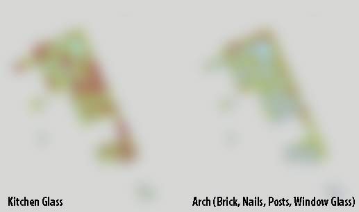
Above: Kitchen glass follows the same pattern being strong in the two areas (mid and south portions of the map) but not as continuous. This possibly shows a division of the areas into two buildings.
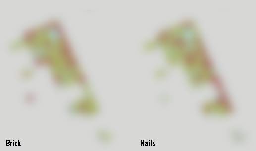
Above: The brick finds show less brick in the storage area (as expected) and another clear division between the storage area and the Kitchen (main house). We also see a break in nails between the two areas but a higher number of nails in the storage area. Again, this makes sense with the storage area being made of mostly wood. Other archaeological digs have also found high concentrations of nails in the cellar area of a storage room which had wood walls around the underground portion of the cellar.

Above: Another obvious distinction between a house and storage building. The house area had large amounts of expensive imported window glass while the storage area had relatively none.
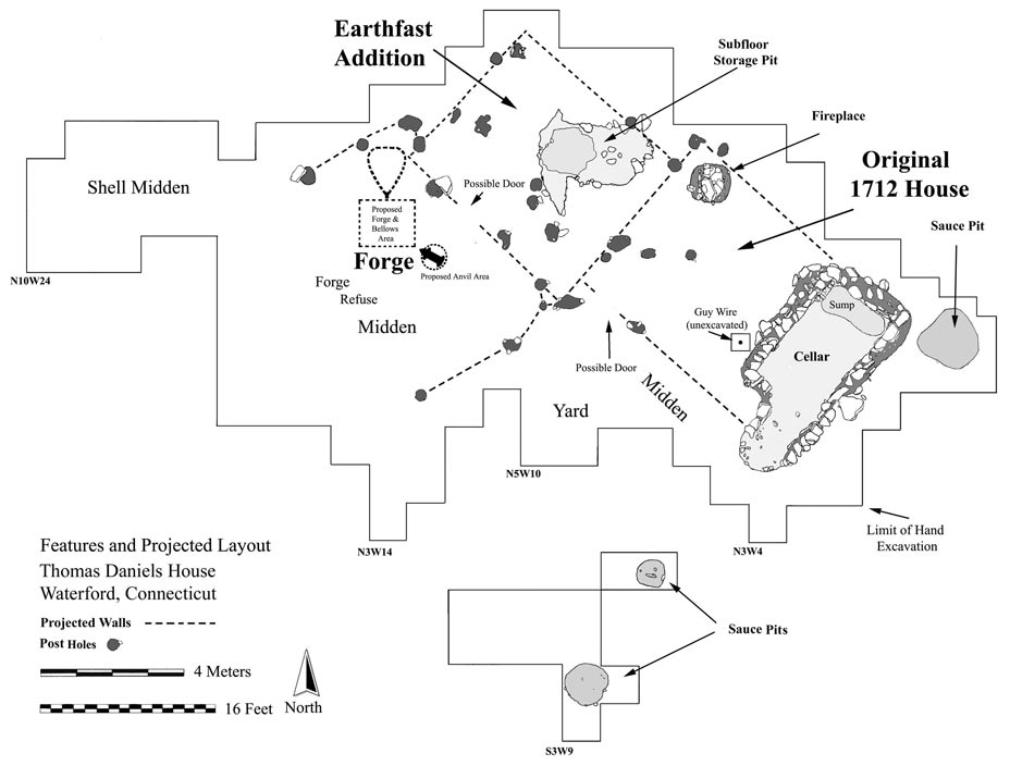
Comparing our finds with a known 18th Century house and store house site points out more verification of our theory (see the Thomas Daniels Archaeological Site below). 18th century storage buildings often had a cellar that was lined in clay. The Granby dig completed a pit (#45) just 4-5 meters south of the pits showing the storage finds and we found a large quantity of man-formed clay pieces. Artifacts (including stoneware) were found much deeper there than in any other pit. We thought this could indicate the extension of the storage building south and the deeper area of a cellar but a distinct line is emerging after pit 81 which shows a drop in artifacts that may show the south-west wall of the storage room. If so, this makes the storage building smaller and means it would not span to the area of the clay found in pit 45. Another explanation for pit 45 may be that this is a third building and maybe a privy. A privy was sometimes capped with clay to contain the odor. This particular area is difficult to access because of two large trees and many tree roots but we do plan to work this area in search of more storage building and privy evidence.
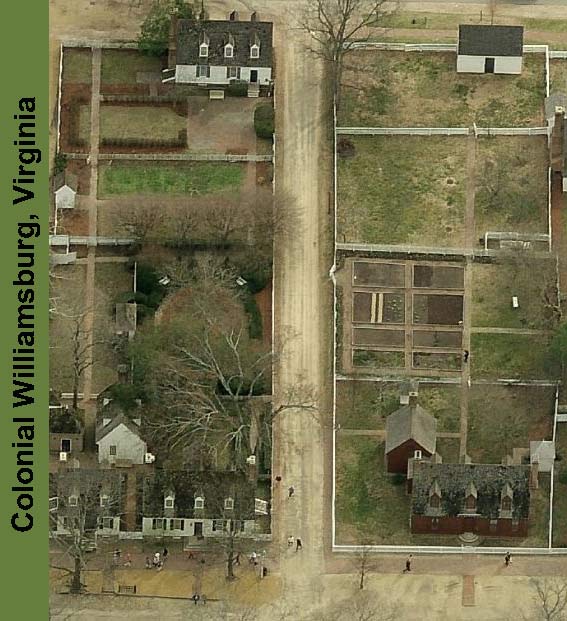
Below is an aerial view of Colonial Williamsburg, VA. Granby would
have looked very much like this in the 1790s and early 1800s. The house
on the lower right has a storage building behind it and a garden in the
back. This is very similar to descriptions we have of Granby lots/homes
(some as small as 100' X 200') for sale in the 1790s.
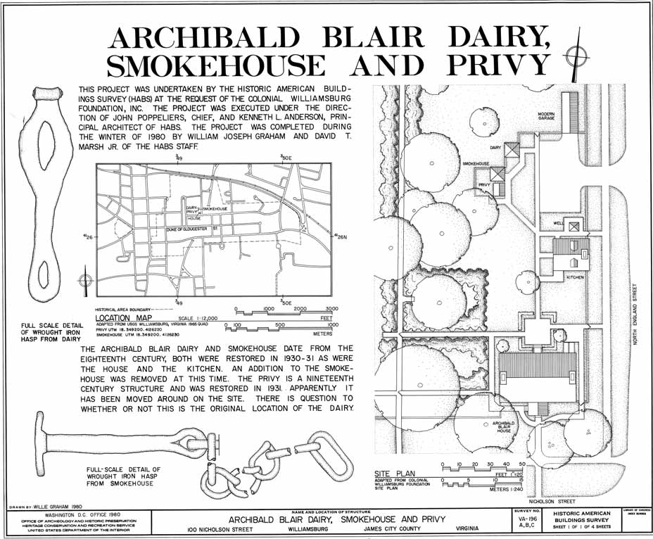
Below are pictures and drawings of out buildings at the former Archibald Blair House in WIlliamsburg.
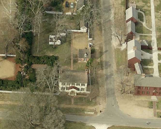
Below is today's aerial view of the Blair site
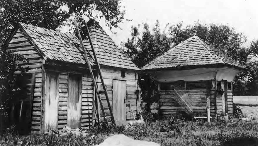
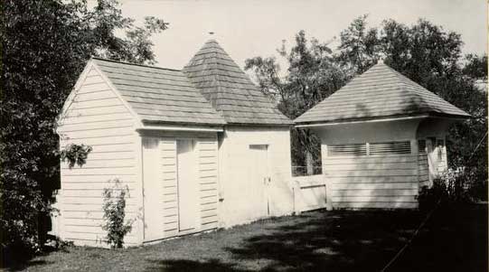
Below are before (early 20th century) and after pictures of the Privy, Smokehouse, and Dairy house.
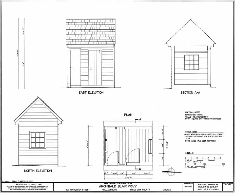
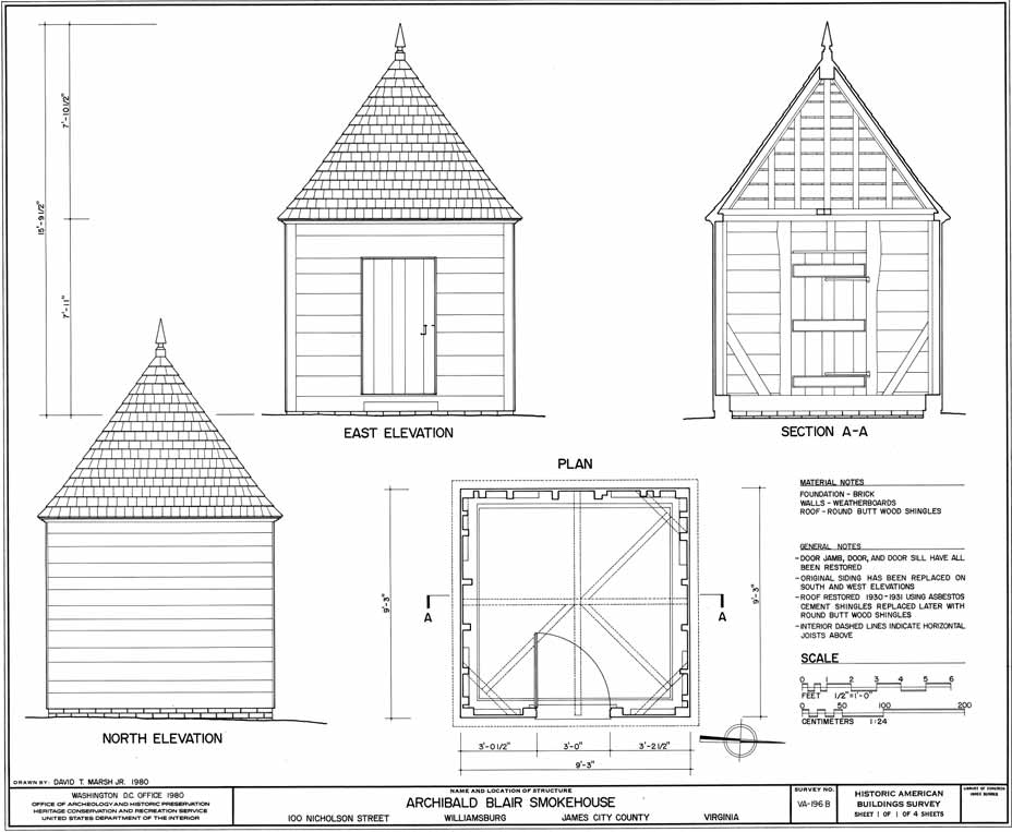
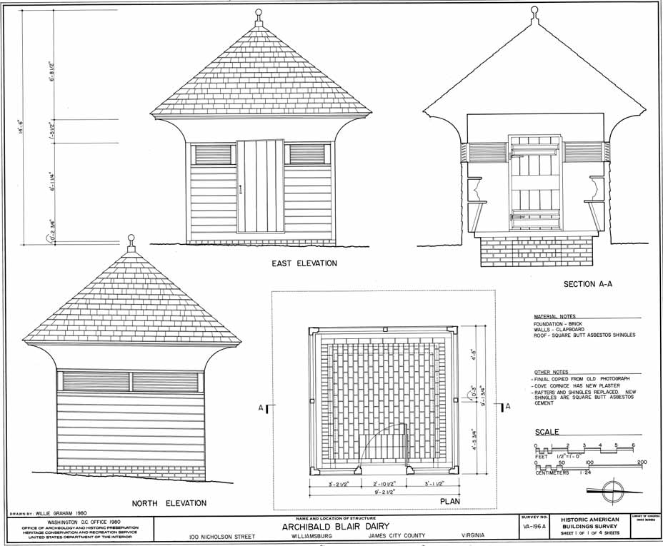
Below are drawings of the buildings made during the restoration.
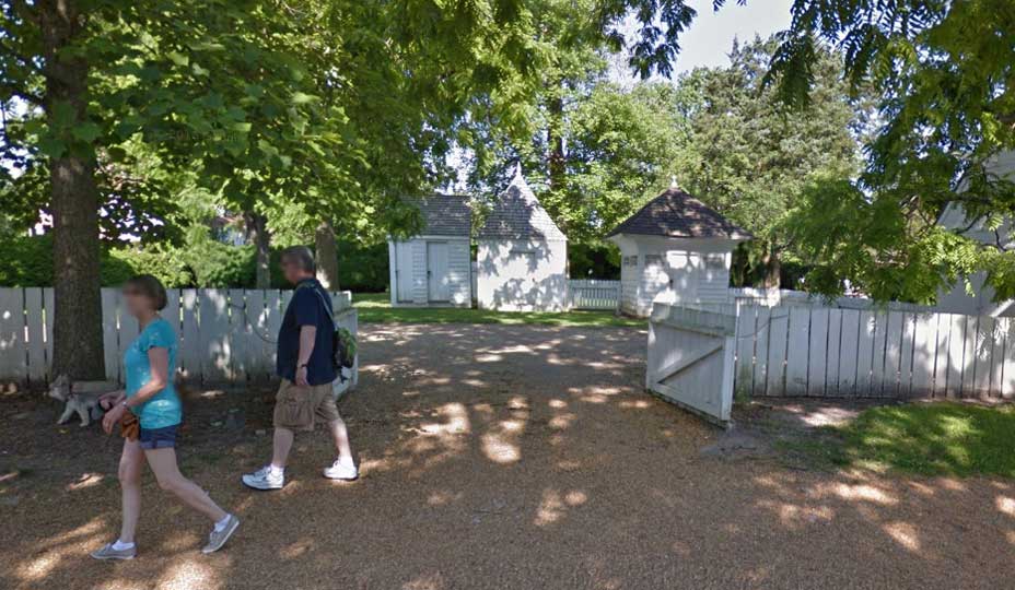
Below is a street view of the out buildings today.
18th Century Thomas Daniels Archaeological Site:
Below are pictures and drawings of out buildings at the former Archibald Blair House in WIlliamsburg.
Below is today's aerial view of the Blair site
Below are before (early 20th century) and after pictures of the Privy, Smokehouse, and Dairy house.
Below are drawings of the buildings made during the restoration.
Below is a street view of the out buildings today.
18th Century Thomas Daniels Archaeological Site: