Locating the USS Lowndes Beach Battalion's evacuation station at Iwo Jima's Yellow Beach
(The photos and map that pin-point the Lowndes' Yellow Beach location)
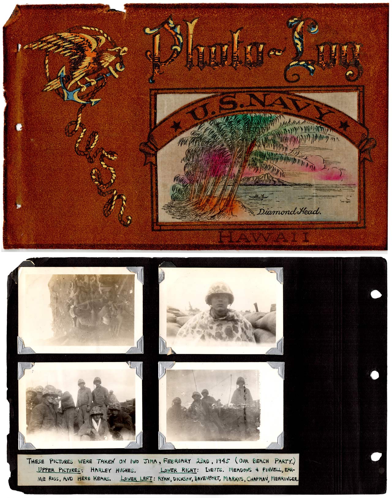
This mystery was partly solved while I wrote the book "Attack Transport: Iwo Jima" in 2022. It starts with photos taken by a Lowndes crewman on D-Day+4. It shows crewman Harley Hughes sitting in a foxhole at the evacuation station on Yellow Beach of Iwo Jima. There were two camera views of Harley. One was towards the beach and the other towards the Iwo air field (180 degree swing.) The photographs were well known within the Lowndes reunion group. I first found them in a photo album that my father (Fred Brinkman) bought in Hawaii after the battle at Iwo Jima. The D-Day+4 date comes from the caption my father had in the album. Below is the album page with the pictures and the caption.
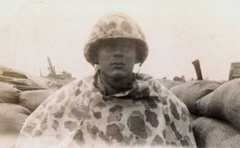
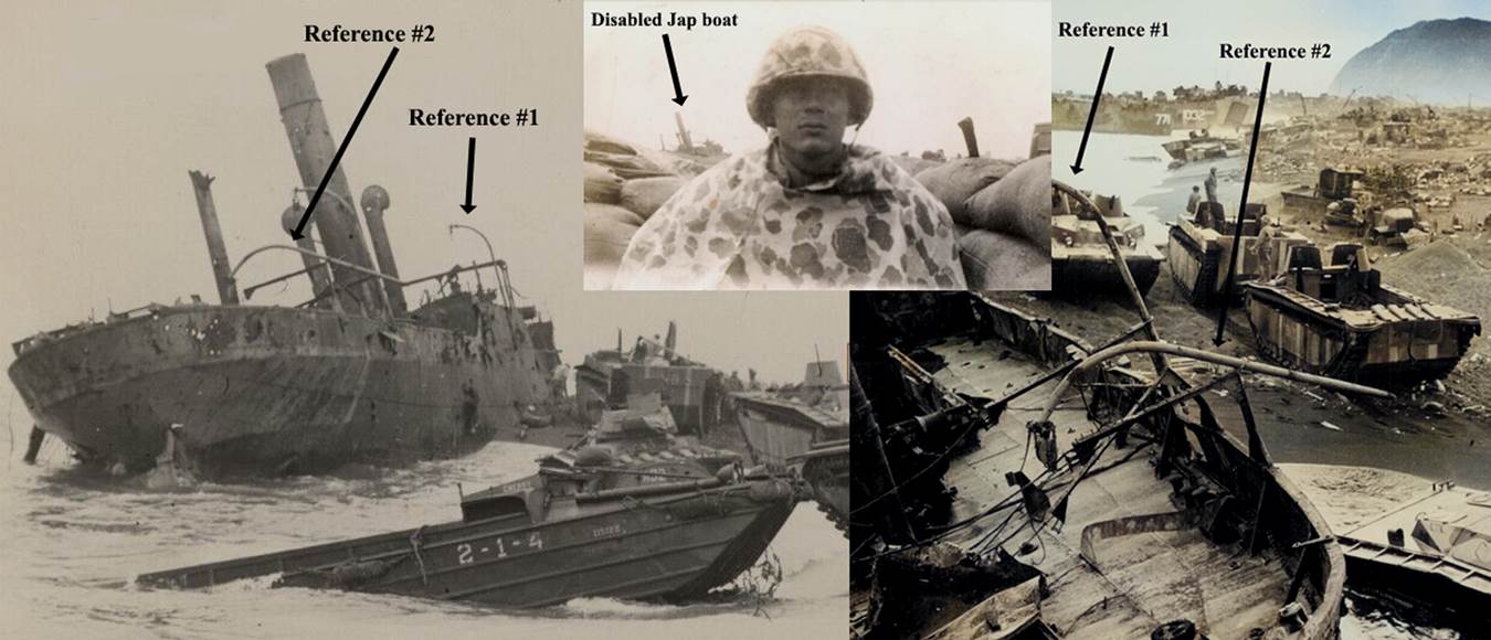
The photograph of Harley Hughes towards the beach: Unnoticed by me until 2022 was a Japanese boat in the background. A quick search of other photos of this vessel proved unsuccessful, and I moved on to other work.
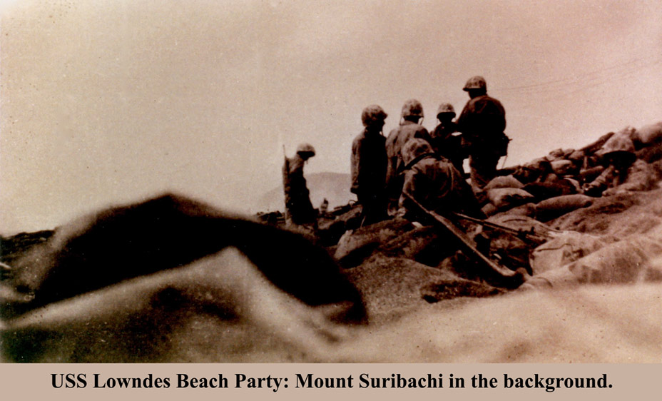
But, a few days later, while looking for photographs of disabled DUKWs at Iwo Jima, I discovered a DUKW next to this Japanese boat. A third photo linked everything together, and we now had a general location of the Lowndes Beach party. Their view of Mt. Suribachi was stunning, and I now understand how they were able to view the flag raising on D-Day+4.
The three photos come together to show the relative position of the background boat on Yellow Beach, and the location of Harley Hughes. The next page shows the stunning view.
By the time the third photo was taken, the Seabees had built roads and cleared much of the debris.

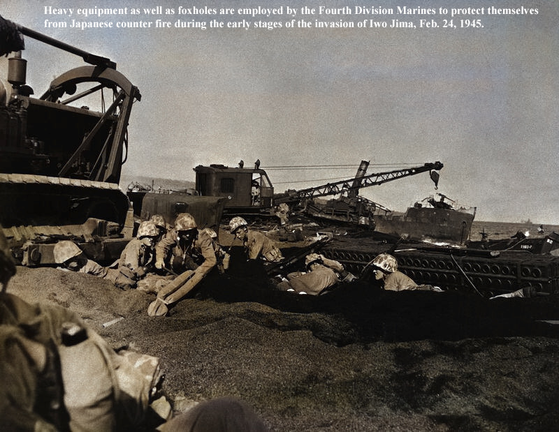
The fighting, and attacks on the beach, were mostly completed at this point. The Beach party's job was probably done, and the focus of the Lowndes men was to handle and treat the wounded on the ship.
From Fred Brinkman's 1945 Iwo Jima account, we see mention of this beached Japanese lugger:
Along the beach a few Jap luggers and landing ships were smashed to hell.
In the same pillbox where we killed that first Jap, some of the Marines spotted two more live enemy soldiers attempting to come out. They dashed back under their holes and refused to come out. They couldn't be seen to hit with a rifle. Then we put the flame-throwers into action. A shot was heard, which meant that one Jap evidently committed "hari-kari". Another body, flaming with fire, soon came rushing out. A barrage of shells brought the burning figure down.
Another Jap sniper was seen setting up a radio inside the wreckage of a Jap ship buried into our beach. He had been directing the firing of Japanese mortar and artillery from the hills of Suribachi and the northern end of the island, enabling them to find our best targets.
Years later, crewman Chuck Munson also mentioned the lugger:
The Navy finally discovered that the wrecked Jap boat was being used as a spotter station.
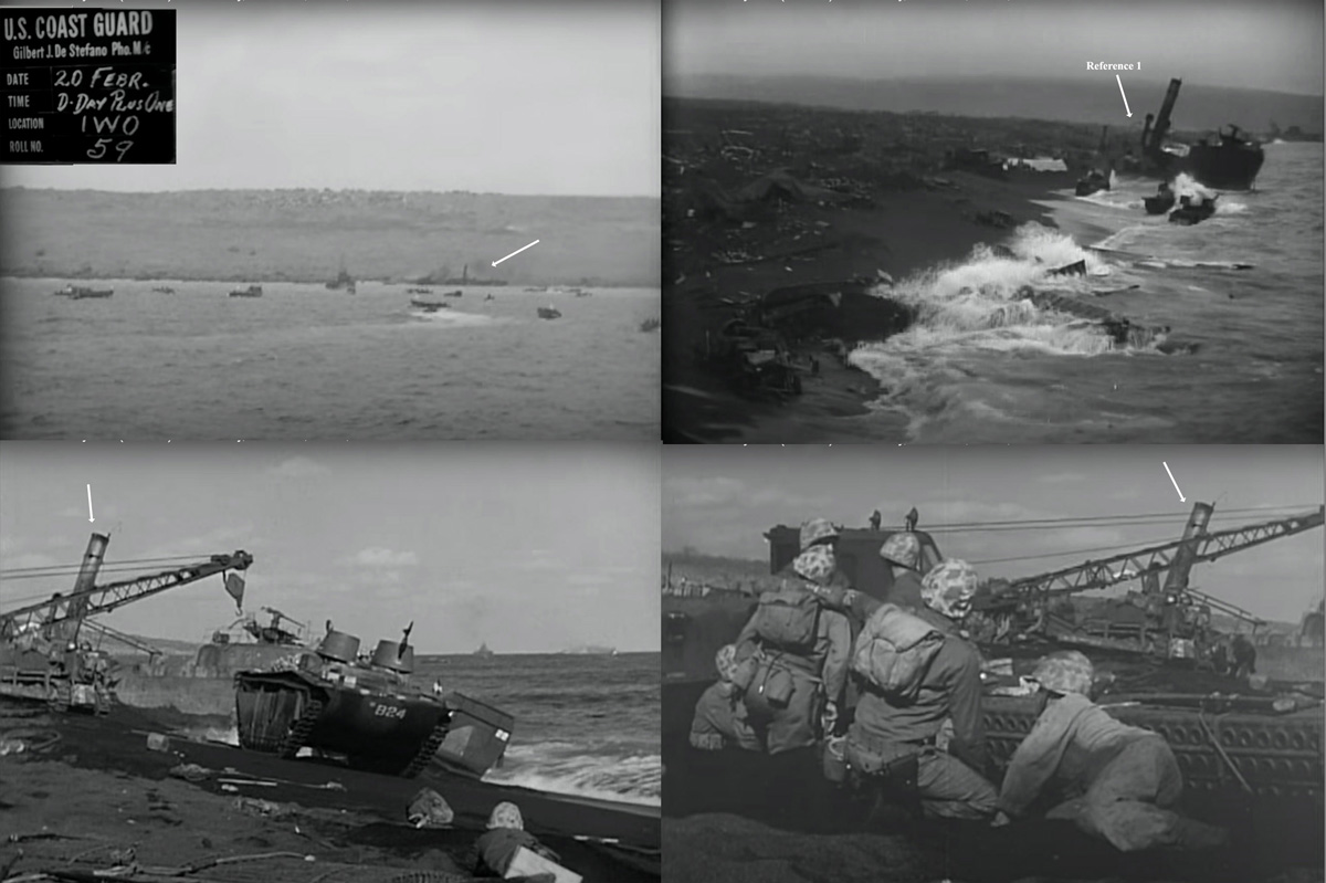
As part of my Lowndes work, I found and digitized hours of film from the National Archives from the APA ship USS Bayfield. The Bayfield was in the same group with the Lowndes at Iwo Jima and their men would work on Yellow Beach. This Bayfield footage shows a Japanese boat aground on the beach on D-Day.
Bayfield Archives video link #1
A few days after the initial troop landings, this Japanese boat can be seen just beyond a crane. Notice the gun at the bow of the boat.
Bayfield Archives video link #2
Bayfield Archives video link #3
A summary of the images in the Bayfield films:
So, how does this boat help us find the exact location of the USS Lowndes Beach Battalion's evacuation station?
It turns out that the Japanese boat appears in many Iwo Jima photos. See if you can spot it. It is in the following 15 photos.
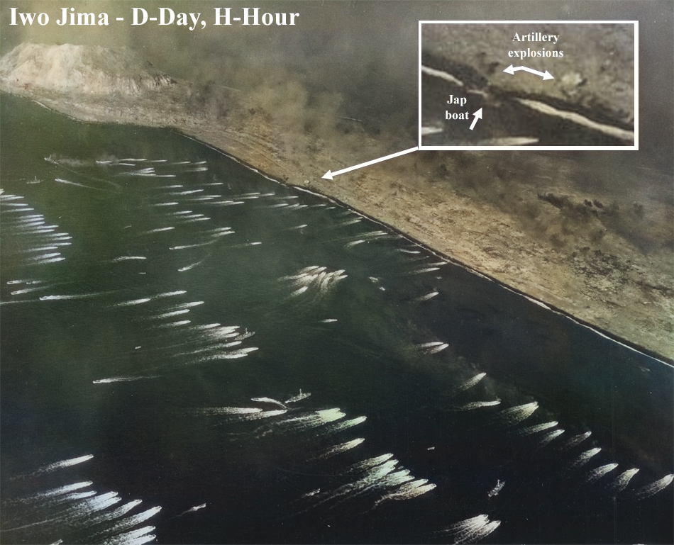


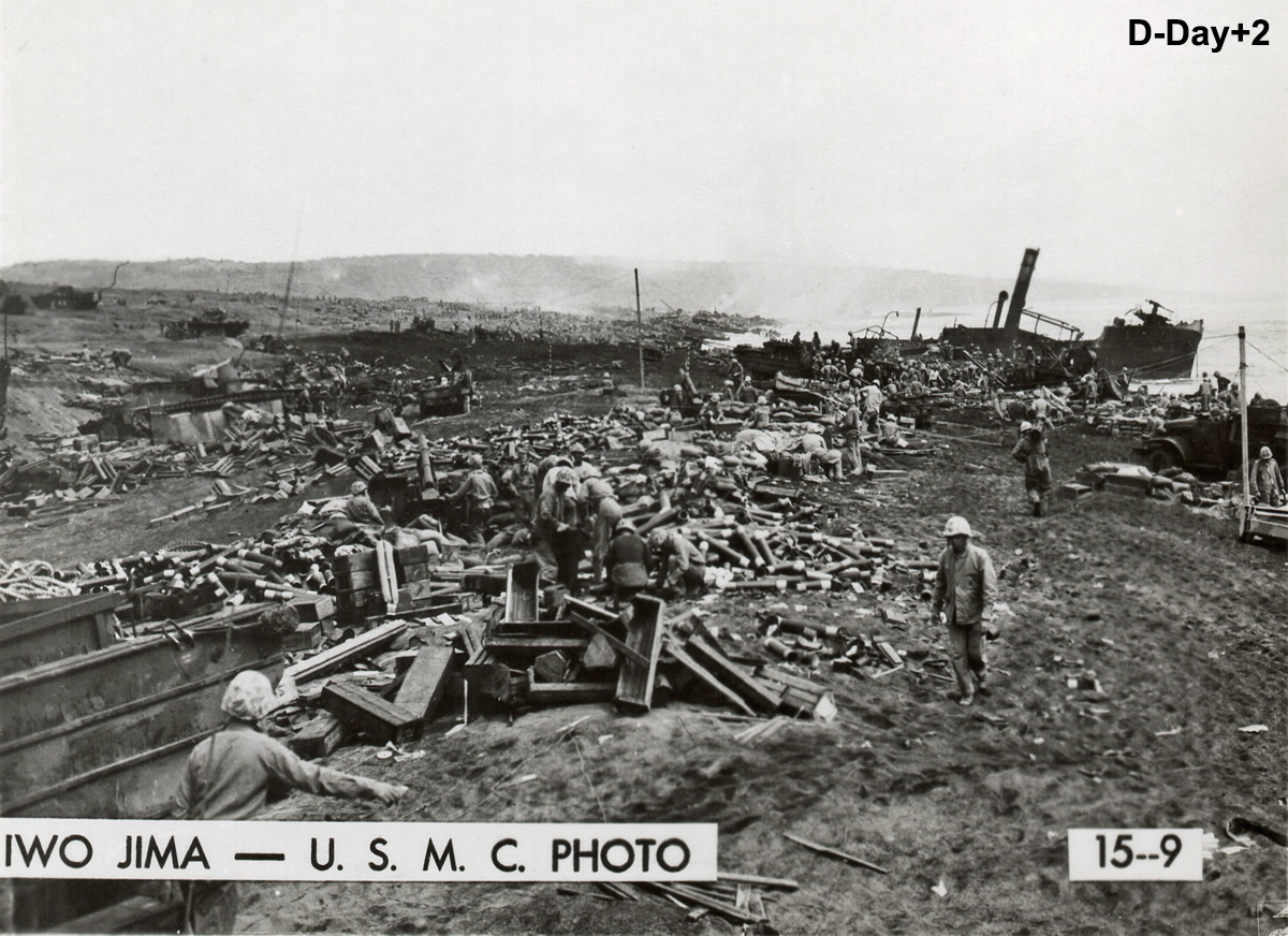

In the above photo from about 10 days after the start of the invasion, the Jap boat has lost much of its mid-section (down to the keel). By D-Day+3, beach crews were using dynamite to try and breakup boats and equipment that were stuck and blocking the beach landings. This may be what happened to the boat's id-section. There also appears to be sections of a dock next to the boat along the shore. Pre-invasion bombing photos which shows a dock just east of this location.
The photo below is another view of the Jap boat on D-Day+2. In the foreground of the photo is the remains of an Lowndes LCVP boat (boat #21). In the image below this is a view of the boat on D-Day+1. This is the image that appeared in the credits of the movie "Flags of Our Fathers." The story behind the Lowndes boat #21 can be found at this link.


Preinvasion maps were made from aerial photos to help locate military installations on the island. Shown above is a map that was updated throughout February and March of 1945. The map includes the Japanese boat (identified as a "beached Lugger with 3" gun on bow") at the division line of Yellow 1 and Yellow 2 beaches. The black&white photo inset is a preinvasion beach photo which shows the landmark of the airfield's retaining wall which is also shown on the map. A double pillbox is shown in the map which is close to the boat. The map shows another pillbox just above this double pillbox which Fred Brinkman (Lowndes corpsman on the beach) described. All three pillboxes are within the green circle that I added to the map. Brinkman noted, in his 1945 letter, that this other pillbox was being used by the Japanese to shoot on members of the Lowndes beach party and on the wounded Marines that they were tending to.
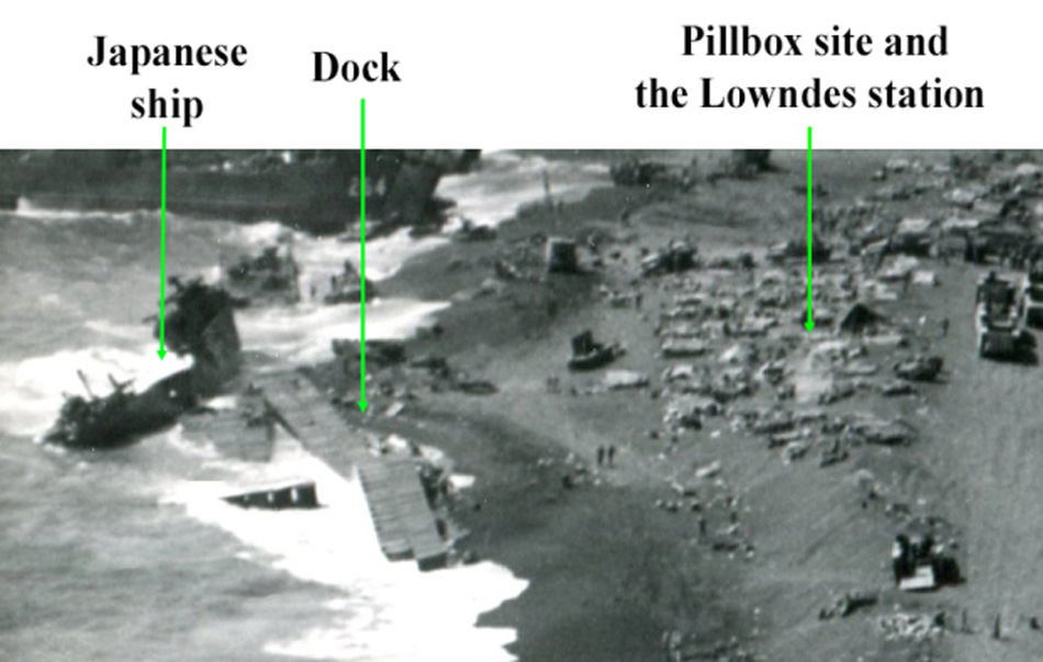
Are there photos of the Lowndes Station? Yes, Joe Rosenthal, just a few days before he took the famous flag raising photo, captured a picture of the Lowndes station. At the end of the war, Fred Brinkman identified many Lowndes crewmen in the photo, including himself.

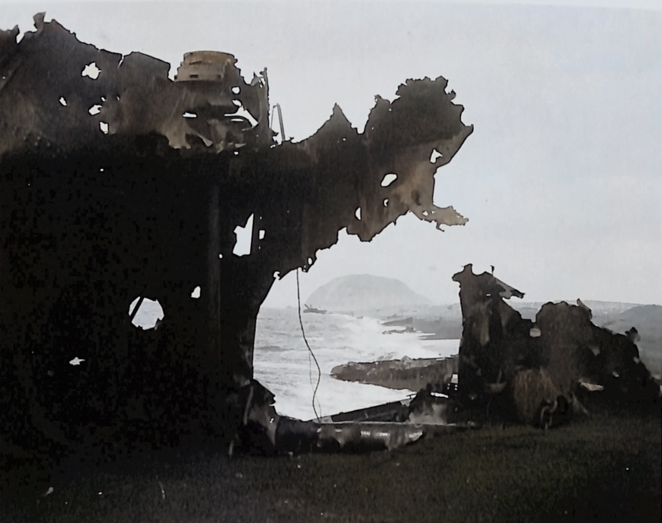
The damaged pillbox can be seen (concrete and rebar). Another search was done through hundreds of Iwo Jima photos to see if similar pillboxes could be found in the area of Yellow Beach. A match was found in a photo of African Americans in a camp next to the station.

The pillbox can also be seen from a previously shown photo which was taken further down from Suribachi. Below is a zoom of that photo.
The Bayfield film footage (Bayfield Archives video link #4) shows men digging out this double pillbox and a soldier walks over to an opening in the structure and appears to throw trash in it
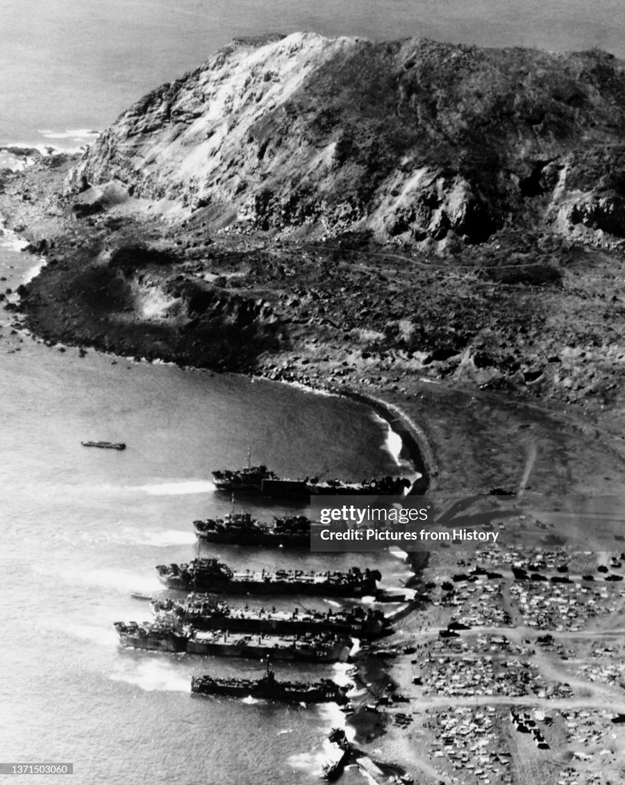
Looking at a high resolution aerial photo from about 10 days after the initial invasion (but before the pillbox excavation), we can now pin-point the exact location of the Lowndes Station.

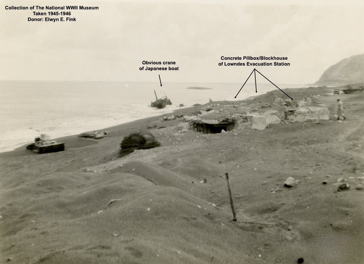
Below is a photo taken in 1945-1946 after the war was over. Only a part of the Japanese boat is still there. The concrete pillbox structure seen in the above photos is very clear in this newer picture and we get a good idea of the relative distance from the boat. This agrees with the Iwo Jima map which was previously shown.
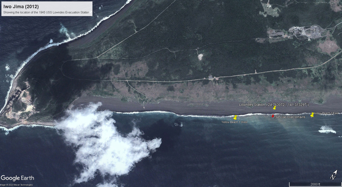
As a final step, I extracted an outline of Iwo Jima from the 1945 map and also the pillbox location of the Lowndes statiom. I overlaided this on a 2012 aerial photo of Iwo Jima so that I could determine the exact location of the Lowndes station. I dropped this location ( 24.763072°, 141.313297°). This is shown below.
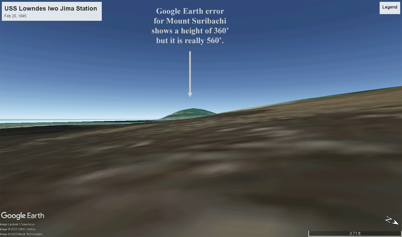
I then used Google Earth to compare today's view of Mt. Suribachi with a photo from the Lowndes beach party on Feb 23, 1945.
Below is the Lowndes photo which was taken on the same day as the flag raising on Mount Suribachi. In fact, the Lowndes photographer may have been trying to capture that event on his camera. The photo was likely taken from the same fox hole that Harley Hughes was using.
Not surprising, Google had a huge error in the height of Suribachi but I made a correction and the view of Mt. Suribachi matches with what the Lowndes men experienced.
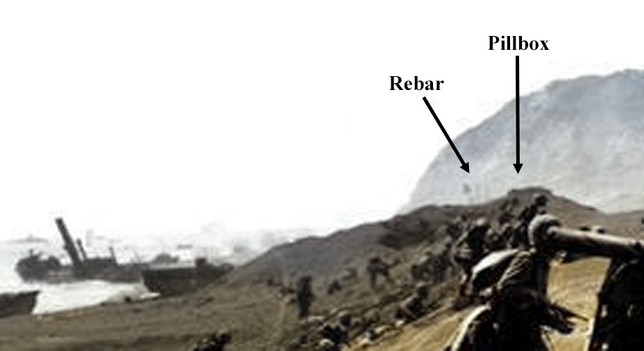
We now go to a second picture of Harley Hughes in the foxhole on Yellow Beach. This time, the camera takes an opposite view with the pillbox in the background.

The Joe Rosenthal picture was taken on D-Day+1. At that time, the beach was jammed with boats and equipment that were stuck in the sand, and the wounded could not be evacuated. Fred Brinkman described this (in his uncensored 1945 letter at this link) as the reason why so many Marines were there, as they were wounded and were waiting to be taken to a ship for treatment. By D-Day+4, the beach was cleared, and Brinkman would soon be relieved of duty at that time. The photograph of Hughes shows the troops have all left. Again, this photo was taken on D-Day+4.
The Hughes photos were taken from within the foxhole at ground level. The Rosenthal picture was taken from probably about four to five feet above ground and at a slightly different angle. Obviously, the two cameras had different focal lengths with Rosenthal's camera being a much higher quality camera.
The photo of Hughes shows the pillbox opening has been partly covered with tarps. The tarp on the left side is draped over the rounded pieces of rebar. The right side of the pillbox opening shows the same large round concrete piece, but it has been moved. The straight rebar pieces are not visible and may have been dislodged. The station took many direct hits from enemy mortar between D-Day+1 and D-day+3, so this may explain these differences. The background Japanese boat in the other Harley Hughes' picture proves that the pillbox matches the map location of the pillbox. The second Hughes photo proves Fred Brinkman's identification of the Lowndes beach party in Joe Rosenthal's "Yellow Beach" photo.
Below are links to the 1945 notes of Fred Brinkman (about the Risenthal photo):
Fred Brinkman photo notes/identification from the Life/Yank magazine article.
Fred Brinkman photo notes/identification from the Time magazine article.

In addition to the presented 1945 photos, the Marine Corps also made films around the Lowndes station during the period the Lowndes Beach party was working the area.
You can view these short clips at this Youtube link. Once again, the area is identified by the beached Japanese boat on Yellow Beach.
On a side note, because of volcanic activity since 2020, Iwo Jima has been rising and many WWII sunk vessels are now visible. The black sand beach has been extended by over 400 feet.
Return to the Main USS Lowndes Page