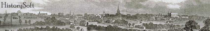
What is HistorySoft?
As a way to share and
inspire the love of local history, the idea of HistorySoft was born in
2010. As a liability protection for electronic devices used in a
Museum indoor location positioning system (invented by David Brinkman),
HistorySoft LLC was created in May of 2011.
For two years, HistorySoft operated with no income. During that time, 4 free
smartphone applications were created for the South Carolina history along
Columbia South Carolina’s Three Rivers Greenway (see a front page story about
this app in The State Newspaper and a Columbia
Rotary Club Presentation), the Confederate Relic Room and Military Museum
(the oldest Military Museum in SC), South Carolina Historical Markers in the
Midlands, and Under Lake Murray (see
a 2013 story about this application The Lake Murray Magazine). Free
applications were also created for Columbia’s Riverbanks Zoo and the Greenville
Zoo. All costs for these projects were covered by the creator, David Brinkman.
Not a single cent was accepted as income.
During this time, Brinkman, and his wife (Odess) also
purchased a property in Cayce, SC which they, and local historians like Dean
Hunt and Leo Redmond, believed might be the area of the old town of Granby (see the 2010 front page
story about this in The State Newspaper). In the late 17th
century, Granby and Charleston were the primary trade cities in South Carolina.
Due to Yellow fever and the creation of Columbia, SC (in 1788), Granby slowly disappeared.
In February of 1865, part of General Sherman’s Right wing camped at what
Sherman called “Old Granby”. After the Civil War, Granby was soon forgotten and
the area became mostly farmland.
The Brinkman’s and a group of dedicated volunteers started
an archaeological dig on the Brinkman Cayce property in May of 2012. Working
almost 20 hours a week for the remainder of 2012, the team uncovered over 4000
artifacts (see the artifacts on the
Finding Granby web site), most of which, are from the Granby period
Historical archival research (also
done by these volunteers) pin-pointed this spot as the primary business
block
of Granby. The success of the “Finding Granby Project” overwhelmed the
team and
it became apparent that the project would require funding to properly
present
the amazing finds as a museum exhibit for all to enjoy. 2015
update: The Granby dig has now found over 12,000 artifacts and
archaeological features from the town of Granby as well as items from
the first European Indian Trader, Thomas Brown. The Granby team also
completed extensive research to determine the location of the British
fort: Fort Congaree II. Under the direction of the South Carolina State
Archaeologist, Dr. Jonathan Leader, the Granby team, USC student
archaeologists, and Explorers Club members, dug a site throughout the
summer of 2014 and located the fort. (see
another front page story about this from The State Newspaper)
The next step for HistorySoft:
Besides the
continuation of the Granby and Fort Congaree II digs (expected to go
through 2015), the evolution of the HistorySoft GPS enabled smartphone
apps (for
the Three Rivers Greenway, the Midlands Historical Markers, and Under
Lake
Murray) led to the challenging task of creating a tour app for the 2012
World’s
most desired destination (Charleston, SC) and probably the most
historic city
in America. David Brinkman’s long time fascination with stereoscopic
photography and the history of Charleston had spawned a book project in
2010.
With the trend toward digital content, Brinkman made the decision to
move his
“Old and New Dimensions of Charleston” to, not only a digital format,
but also to
a mobile/smartphone GPS enabled app. With this project, HistorySoft
moves to a
role of income generator for the “Finding Granby Project” (which we
hope will
pay for a museum display and carbon dating of several key finds) as
well a
stimulus for future history projects. Brinkman also hopes to fund the
replacement of an incorrect historical marker which led to his interest
in
local history in 2005. This historical marker mistake ultimately led to
Brinkman’s discovery of the long lost sites of the Broad River
Confederate
Bridge and General William Sherman’s Union Army pontoon crossing in
1865 just
before the burning of Columbia. Brinkman’s Civil War
Bridge story was another front page story of The State and was featured on
the 2009
season finale of the nationally broadcast PBS History Detectives show. For
this and the extensive
research Brinkman completed on the historic river crossings in the Columbia
area, he received the Historic Columbia Foundation's 2009 Helen Kohn Hennig
award for historic preservation.
Beyond Charleston and Granby lies other projects like 3D
“Old and New Dimensions” of St. Augustine, FL, as well as over a dozen other
major US cities which Brinkman has already processed 100+ year-old stereoscopic
images and historical marker data.
This is HistorySoft.
|