Welcome
The Fort Congaree II Dig team completed a dozen dig
days over the summer of 2014 with the help of over 40 volunteers. All
work was overseen by Dr. Jon Leader (the South Carolina State
Archaeologist) and the team included six other archaeologists and many
members of the Granby dig team.
The first dig location (14 units) was
completed by the end of August. When we started on May 31, 2014, within
a couple of hours, the team came across a feature in Unit 3 that had
characteristics of a palisade wall. Subsequent Units were opened to
follow this feature. By the end of August, we had also found attributes
of a fill area (possibly the documented ditch around the outside of the
fort) on both sides of the possible wall feature. Our site selection
was chosen to hit the North-East bastion of the fort based on two
mid-1700 surveys. The potential wall and ditch find could indicate the
bastion. Most features were found at the bottom of level 1 (10cm) or
within level 2 (10-20cm). For this reason, some pits were not dug
beyond a 10-20cm depth. Some units were dug to a depth of 40-50cm at
which point artifacts were no longer found. We found about 160 possible
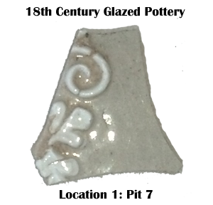
period artifacts in the 14 units. There were several obvious period
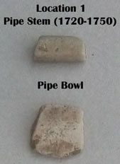
pottery pieces and several pipe pieces including a 1720-1750 pipe stem.
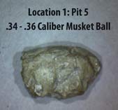
A .35 caliber musket ball was also found deep in one of the units. On
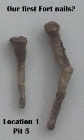
both sides of the possible wall feature, we found period handmade
nails. At the end of the summer, a resistivity survey was completed in
the backyard of the site. The results showed a continuation of the
ditch feature. Documentation and feature/artifact photos for each level of each unit can be access at this
link.
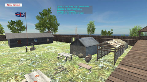
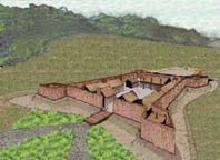
Below is an image of the 3D model of Fort Congaree II,which is based on research and archaeology. Click here to see this model in a simulation scavenger hunt game.
On Memorial Day weekend (2014), we officially started the physical search for the lost and forgotten 1748 - Fort Congaree II.
Fort Congaree II Background
In 1748, in response to deadly Indian attacks against the first
South Carolina backcountry settlers, the palisaded British outpost Fort
Congaree II was built. Its location was at an established Indian
crossing just below the fall line on the Congaree River where, today,
you find the City of Cayce, SC. Fort Congaree II would serve its
initial purpose of protecting early European settlers and, around 1761,
became the launching ground for attacks against the Cherokee in the
French-Indian War. During this time, it was also the training ground
for young men who would later become heroes of the American Revolution.
Among them: Francis Marion, John and William Moultrie, Isaac Huger, and
Andrew Pickens. From Dan Tortora's "Fort Congaree II": "Fort Congaree
II played a vital role in the history of the Midlands of South
Carolina. It was built at a time of rapid growth and settlement in the
area. It commanded a strategic position at an important crossroads: at
the intersection of the Congaree River, the Cherokee Path and the
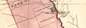
northern limits of Saxe Gotha Town (Saxe Gotha was the first
backcountry settlement of South Carolina up from Charlestown). In
peacetime, Fort Congaree II's garrison bustled with activity. Farmers
and merchants, African slaves, indentured servants, Catawba Indians,
local settlers, and ministers visited often. Soldiers and settlers
worshipped together, conducted business, and even married each other.
The fort protected upcountry settlers from Indian attacks and gave them
peace of mind. It helped South Carolina support the struggling but
loyal Catawba Nation. Its soldiers left their wives and children behind
and participated in the opening battle of the French and Indian War.
The fort's first commander (Lieutenant Peter Mercier) made the ultimate
sacrifice to the British cause. The story of Fort Congaree II offers a
glimpse into an oft-forgotten chapter in the history of Colonial
America."
As the town of Granby developed a few hundred feet
north of Fort Congaree II, the fort was shut-down in the mid-1760's. It
would soon be forgotten with the Revolution approaching. The last
reference to it appears in a 1935 newspaper article by the late and
still well-known South Carolina historian, Dr. Edwin Green. Dr. Green
makes a plea for some type of marker to be placed at the site of the
"last signs of the fort." A marker was never placed but, a few years
later, the first aerial photos (1939) of the area show a pattern in the
shape and orientation of the fort in a cleared (but un-plowed) field at
the location that Dr. Green mentioned. This significant part of our
Colonial history has been almost entirely forgotten, and much evidence
of it has been erased. Our team of historians and archaeologists
believe, however, that modern day technology and archaeology would
reveal the covered ditch of the old fort and features within the fort.
Digging in these areas should, at the least, uncover the remains of the
cellar of a fort building and nails from the period. We would also
expect to find some personal items like glass bottle fragments, tobacco
items (pipe stems and pipe bowl pieces), Indian trade goods, ceramics,
evidence of the barracks and post holes. Military artifacts related to
the Cherokee conflict may also be found.
There is also a
series of dives planned in the Congaree River where the old Indian
trail would have crossed at the site of the fort. Our goal here is to
inspect an unknown sunken vessel and look for any signs from the fort's
period. Although not a primary goal of the project, most historians now
believe the first Europeans crossed this area in the Hernando de Soto
Expedition of 1540. The oldest maps of the region only show one Indian
crossing, and it is at this Fort site. It was well documented (from the
de Soto Chronicles) that the 1540 expedition was led through this area
by Indian guides so we will consider this in the dive phase of this
work. No item has ever been found in South Carolina from the de Soto
Expedition.
With major development underway for Cayce's
"12,000 Year History Park" (being developed under the direction of the
National Parks Service) just a few hundred feet away from the Fort
site, and the expansion of the Cayce Riverwalk through the Fort site
(next year), our discoveries in this Flag Expedition would bring Fort
Congaree II (and a part of Colonial American history) back to life.
This could lead to some type of site recognition like that proposed by
Dr. Edwin Green in 1935 and the possible inclusion of the site in the
"12,000 Year History Park".
